
Helping planners deliver liveable, walkable neighbourhoods
How do you create liveable neighbourhoods where walking is the most convenient and joyful way of getting around?
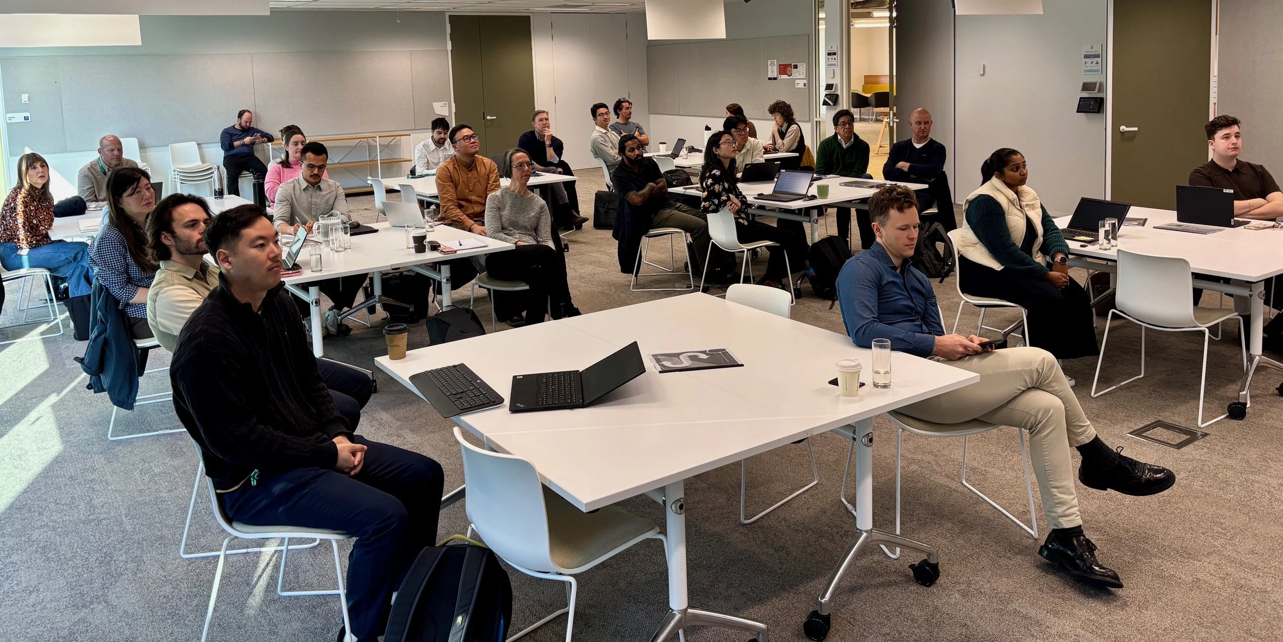
That’s the question we tackled in two full-day workshops that we delivered recently for the NSW Department of Planning, Housing and Infrastructure (DPHI) and Transport for NSW (TfNSW). Titled Enhancing Walkability Through Land Use Planning, we brought together around 100 planners to explore the tools, data and strategies needed to assess, and advocate for, walkable development.
Marc Lane and Sara Stace combined our expert knowledge, real-world case studies, interactive learning and some good-natured planning humour to keep the sessions lively and engaging.
Workshopping with a twist
Each workshop had around 50 participants and included a mix of presentations, discussions, a site walk and very lively card game.
What Makes Places Walkable?
We kicked off with the fundamentals: what do we really mean when we talk about walking and walkability?
For example, children and older people walk much slower than able bodied adults, so the ‘standard walkable distance’ to key amenities like shops and schools depends on who is accessing them. We looked at how land use planning (e.g. 15-minute neighbourhoods, and proximity to jobs and daily destinations) can minimise the need to travel, reduce car dependency, and increase the likelihood of walking.
Measuring Walkability
Once we know what matters, we need to measure it. We introduced a suite of practical tools that planners can use in their day-to-day work:
Walkability Checklist by the Committee for Sydney, Vivendi Cities and WalkSydney
NSW Government guidance such as:
Walking Space Guide
Walkable Public Space
Design of Roads and Streets (DORAS)
Road User Space Allocation (RUSA)
Built Environment Indicators to track performance over time
AI Modelling Insights from Vivendi Cities, revealing the key ingredients for walkable neighbourhoods: density of housing and jobs, things to see and do, slow fine-grained streets, and quality public transport access.
Putting it into Practice
The sessions didn’t stop at theory. We figuratively walked through:
Business case tools to quantify the benefits of walkability
Strategies to integrate land use and transport at precinct level, working across government agencies
How planners can use metrics to hold applicants accountable for delivering walkable outcomes.
The Fun Stuff - getting on our feet
To experience walkability first-hand, we took a field trip to the Westmead Health and Innovation Precinct, travelling by foot, train and light rail to see theory in action. Participants explored:
A proposed through-site link that Vivendi’s demand modelling predicts will increase walking and cycling throughout the whole precinct
How mixed-use development encourages walking for everyday needs
Plans to reduce traffic on two major roads (Hawkesbury Rd and Darcy Rd)to improve liveability in the precinct.
We finished with a custom-designed card game, full of planning jargon and in-jokes, which turned out to be a massive hit with all participants. We’ve had lots of requests to sell it—watch this space :-)
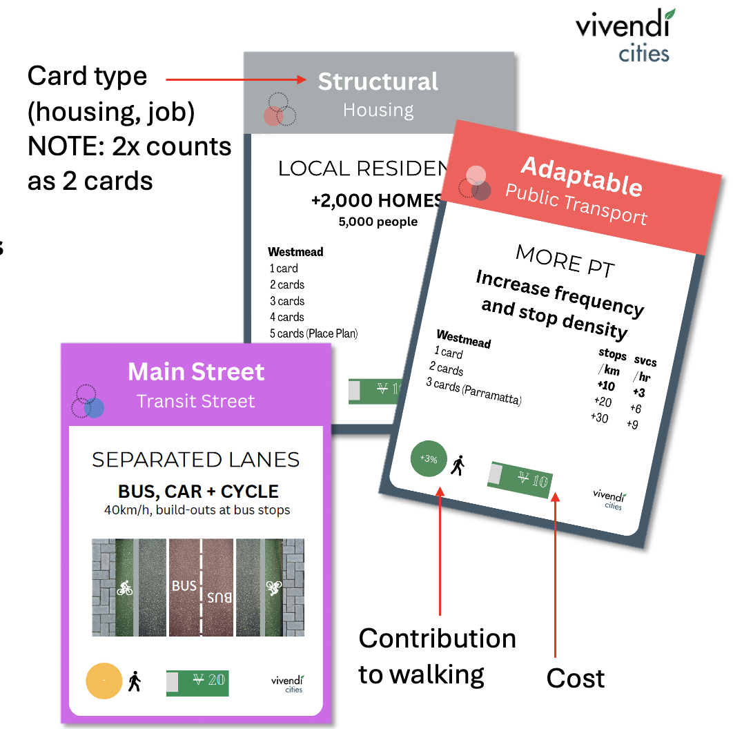
The Walkable Planning Game
The card game includes a range of options that planners can choose from to make a precinct more or less walkable. But there are tradeoffs! Some options cost more, some increase housing or jobs but reduce walkability, and others result in more traffic.
The Takeaways
Participants walked away with the skills and confidence to:
Understand what makes places walkable (and what doesn’t)
Use data and design tools to advocate for better outcomes
Apply NSW Government guidance and best practice
Work across agencies to deliver integrated planning
Ensure developments are truly walkable using practical, evidence based tools and data.
What did participants say?
“I found the tools and guidelines super useful - I’m definitely going to use these in my day to day work.”
“I learned a lot from this workshop that I didn’t know about walkability and liveability, and how I can make this better as a planner.”
Want training for your team?
If you want to find out how we can help your team to make places more walkable and liveable - whether you’re in a council, government agency, consultancy or academia - send us a message!