

Improving the Sydney Plan
The Sydney Plan needs to be a directive spatial plan to be effective. In Vivendi’s view, the Sydney Plan should:
1. Be specific and directive to be effective: Set measurable outcomes and clear tests that guide decisions
2. Address the job and transport deficit in the west: Provide sub-regional mapping and an strategy to grow jobs and improve connectivity within existing areas first
3. Map and protect long-term regional rail corridors: Include a comprehensive transport network plan, corridor protection, and locate 90% of new housing where jobs are reachable by public transport
4. Require land use mix around density for sustainable development: Ensure uplift is tied to local centres, childcare, daily services and open space within walking distance
5. Facilitate walkable, local schools: Plan schools near centres and enable safe, walkable catchments that reflect education and social trips
6. Shift to form-based design and strengthen design quality measures: Prioritise urban form and street quality, including coherent street walls where appropriate
7. Remove greenfield expansion, or at least map constraints: Avoid encouraging further greenfield release without full constraints mapping, noting new greenfield is unlikely to be serviceable nor deliver homes close to jobs and amenity.
8. Mandate affordable housing, social infrastructure and vibrancy: Set clear affordable housing expectations, establish a social infrastructure contributions approach and map locations intended for long-term vibrancy
Helping planners deliver liveable, walkable neighbourhoods
Vivendi also offer training for walking, cycling and micromobility. Here is a rundown of a recent training session we provided to DPHI in June 2025.

How AI can shape the future of urban and transport planning
Cities are complex, constantly evolving systems shaped by land use, transport, economics, and social change. Traditional planning tools often fall behind, leaving projects mismatched to the communities they were meant to serve. Artificial intelligence (AI) offers a new way forward by analysing vast, real-world datasets and adapting forecasts in real time.
The blog explores five areas where AI is already reshaping urban and transport planning.
Done well, AI has the potential to untangle what Saskia Sassen called cities’ “invisible complexity,” helping planners avoid costly mistakes and build better, more liveable communities.

Planning for walkability
Marc Lane and Sara Stace co-authored a paper with Estelle Grech which was published in the Planning Institute of Australia’s New Planner magazine. Read a summary of the article here.
Making sure our neighbourhoods are walkable by design
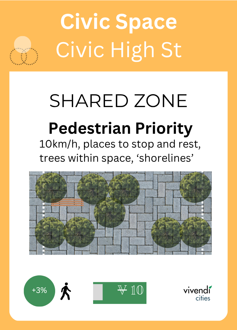
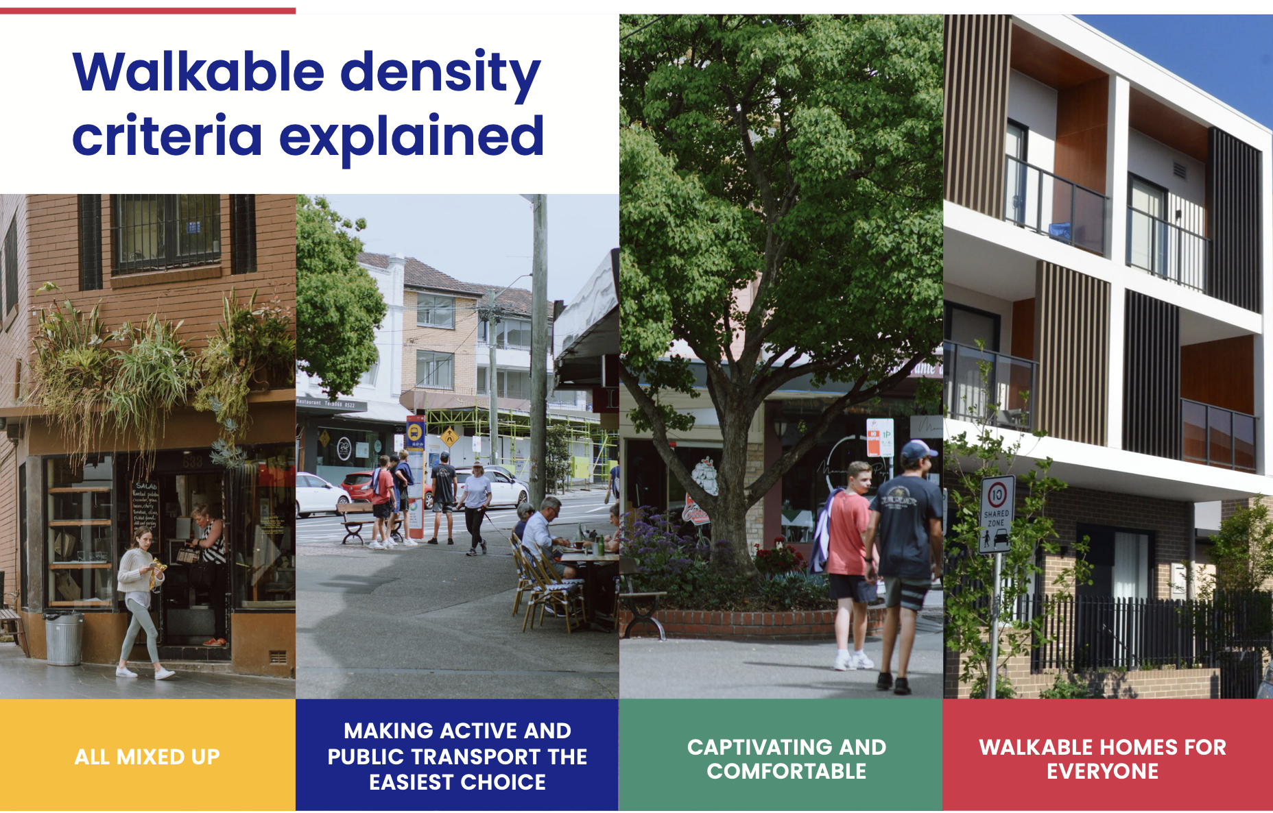
Sydney is on the cusp of its most significant urban transformation in generations. New tools like the low- to mid-rise SEPP and transit-oriented developments offer a golden opportunity to create walkable, liveable communities – where walking is the most enjoyable way to get around. This will not happen through density alone. Working with Committee for Sydney and WalkSydney, we now have a Walkable Density Checklist at a neighbourhood scale to ensure that, as we transform these places, we embed a walkable urban form.

Upcoming Webinars
Come and learn about Vivendi’s unique AI models for predicting pedestrian safety, walking and cycling during a lunchtime seminar soon…

Bringing Portfolio Management to Life
We’ve put together a few thoughts on Benefits Realisation and the advantages of a Program Management Office - both of which ought to be key considerations for the successful delivery of any large program or project.